
Similar to other national parks in the country, bicycles are generally allowed on most roads in Great Smoky Mountains National Park. Although this is the case for most, if not all roads, it is important to bear in mind that inclement weather and other unfavorable conditions should dictate when you should explore these trails.
As most of the national park is geared towards hikers, campers and individuals who simply would like to explore nature, this in no way means that trails meant specifically for bikers do not exist. Bicycles are allowed on the Gatlinburg, the Oconaluftee River and the lower Deep Creek Trail. These trails have been set aside for people wishing to simply take a stroll through the park on a bike, rather than participate in other less intensive physical activity mentioned above.
Cove Loop Road: An incredibly popular trail for cyclists of all levels, Cove Loop Road is an 11 mile loop that offers interesting vistas of wildlife, 19th century buildings and reserves that are less popular. In the summer and fall, bicycles can be rented from the Cades Cove Campground Store, which is conveniently located near this loop.
Townsend Bicycle Path: Known as the “Peaceful side of the Smokies,” this path is perfect for families with children of all ages. This paved trail has relatively hills, beautiful scenery and is generally geared towards people who may not have substantial cycling experience. The Townsend bicycle path also allows access to a wide array of local spots to either explore before or after your scenic route. Also, another important aspect to keep in mind is the fact parking is available on both ends of the path.
Tremont Road: To successfully navigate Tremont Road from Townsend bicycle path, head to one side of the path labeled with a “Y.” If you bike around this path for a few times, it would actually be around 5 miles in distance.
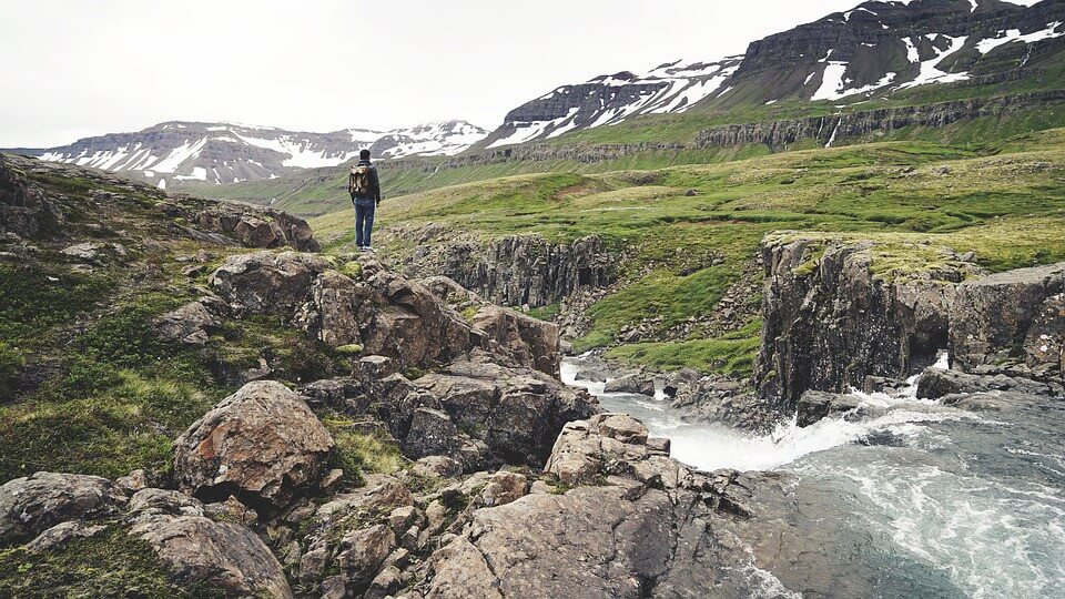
Lakeview Drive: Also known as the “Road to Nowhere”. This is a lightly traveled paved road that winds eight miles into the Great Smoky Mountains National Park just north of Bryson City, NC. It’s a moderate ride with great views of Fontana Lake and the Southern Appalachians.
Foothills Parkway: The Foothills Parkway between US 321 and US 129 (about 16.5 miles) offers cyclists outstanding views of the Smokies and is not as heavily traveled by motorists as the roads in the park. As “foothills” is in the trail’s name, expect a serious workout when traversing this terrain.
Blue Ridge Parkway: You can ride a short portion of this road, beginning just outside of Oconaluftee, or you could ride the entire 469 miles all the way to Waynesboro, Va. Of course you should expect some major climbing right from the start. See some of the links below for more details about riding this classic cycling touring route.
Gatlinburg to Newfound Gap: For strong and experienced cyclists looking for the ultimate challenge, you could always try the climb up to Newfound Gap. This ride is an average grade of 5.2% over the course of 13 miles, which is probably enough to make this a category 1 climb in the Tour de France! If you decide you want to tackle this climb, it’s best to start just after dawn so that you can avoid the heavier traffic. Also, it might be a good idea to carry a flashing strobe to give drivers a heads-up while you’re pedaling through the tunnels.
Mountain Bike Routes
Cades Cove Loop Road: This 11-mile one way road is also a popular option for people on hybrids and mountain bikes. If you happen to ride this loop on a mountain bike, please pay close attention to the weather conditions, while also making sure your bike is in mint condition.
Gatlinburg Trail: The Gatlinburg Trail travels 1.9 miles one-way from the Sugarlands Visitor Center near Gatlinburg. It’s a relatively flat trail that runs through the forest alongside the West Prong of the Little Pigeon River. The trail offers beautiful views of the river, which is ideal for a relaxing day out or even for some nature photography.
Oconaluftee River Trail: The Oconaluftee River Trail travels 1.5 miles one-way from the Oconaluftee Visitor Center to the outskirts of the city of Cherokee, NC. It’s relatively flat, but does have a few small hills. The trail passes through the forest alongside the Oconaluftee River and offers beautiful views of the river. The Oconaluftee River Trail is frequently used by joggers walkers and visitors with dogs.
If any of the above trails are of specific interest to you, be sure to read more about when to visit, the best paths for you and other optimal times to explore the gorgeous nature this are has to offer here.